
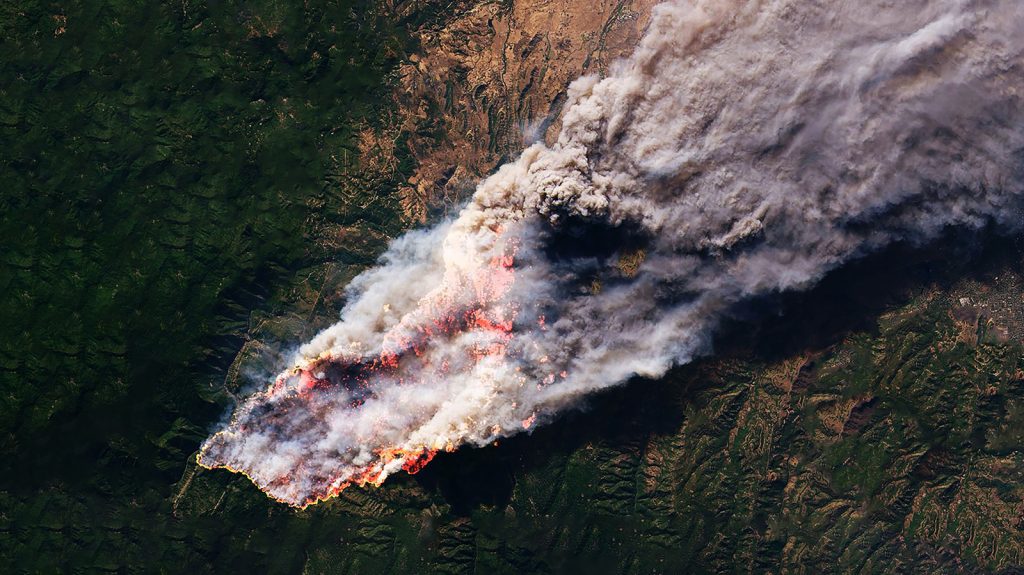
Wildfires across North America and around the globe are becoming hotter, faster, and far more destructive, with fire seasons in the Western United States now lasting over a month longer than they did 35 years ago. Traditional ground towers and aerial patrols frequently struggle to catch small roadside ignitions or remote strikes before they spread into massive conflagrations.
To address this challenge, the FireSat satellite constellation uses low-Earth orbit satellites equipped with multispectral infrared imaging and artificial intelligence to spot thermal anomalies as small as 16 square feet. Developed by Muon Space alongside the Earth Fire Alliance, Google, and the Bezos Earth Fund, this satellite network provides near real-time thermal monitoring to save lives, protect timber resources, and prevent billions in property damage.
The Technology Behind FireSat Orbital Thermal Detection
The initial operational fleet of FireSat spacecraft relies on the custom Condor-M satellite platform built for low-Earth orbit deployment. Each satellite carries a specialized multispectral infrared imaging payload capable of measuring six distinct bands of infrared light. This wide spectral bandwidth enables the hardware to detect high-temperature sources down to approximately 16 square feet (1.5 square meters), even through heavy cloud cover or dense smoke plumes.
Each spacecraft scans a massive swath of land measuring roughly 930 miles wide during a single orbital pass. To handle the immense volume of observational data, the system runs on the Muon Halo computing platform integrated with artificial intelligence models provided by Google. The AI algorithms compare incoming frames with thousands of baseline images taken over the same location, evaluating current weather metrics to verify genuine fires while eliminating false positives from solar reflections or heated surface structures.
FireSat Constellation System Specifications
To demonstrate how FireSat compares to standard satellite observation systems, the core hardware specifications and program milestones are detailed in the table below:
| System Metric | Specification & Target Detail |
|---|---|
| Minimum Detection Footprint | 16 square feet (~1.5 square meters) |
| Sensor Payload | Multispectral infrared (6 infrared bands) |
| Swath Width per Pass | Approximately 930 miles (1,500 km) |
| Spacecraft Architecture | Modular Condor-M low-Earth orbit satellites |
| Active Fleet & Orbital Deployment | 3 active satellites (Launched July 7, 2026, via SpaceX Transporter 17) |
| Planned Fleet Size | 50 low-Earth orbit satellites at full capacity |
| Target Revisit Frequency | Twice daily currently; target hourly by 2029; every 20 minutes at full deployment |
| Key Partners & Backers | Muon Space, Earth Fire Alliance, Google, Bezos Earth Fund, Gordon and Betty Moore Foundation |
| Projected U.S. Economic Savings | Over $1 billion annually in direct fire damage reduction |
Rising Wildfire Risks and the Urgent Need for Early Detection
Recent environmental data underscores the rapid escalation of global wildfire severity. Between January 1 and July 24, 2026, the National Interagency Fire Center documented 41,984 wildfires across the United States that burned over 4 million acres. By comparison, during the exact same timeframe in 2025, 39,279 fires burned just under 3 million acres. Globally, forest fires now account for roughly half of all annual tree cover loss.
Compounding the threat, higher nighttime temperatures prevent fires from cooling down and naturally dying out overnight. Human infrastructure and vehicular traffic remain major triggers for ignitions along roadsides. FireSat’s precursor test unit, known as “Protoflight,” proved the effectiveness of space-based tracking during its year-long pilot phase. While orbiting and generating over one million multispectral photos, the prototype successfully flagged a minor roadside blaze in Oregon that all existing monitoring networks missed.
Future Roadmap and Constellation Scaling
The operational launch of three FireSat satellites aboard SpaceX’s Transporter 17 mission on July 7, 2026, marks the first phase of an ambitious orbital network. At present, the trio of satellites monitors fire-prone regions roughly twice per day. By 2029, the Earth Fire Alliance and Muon Space plan to scale coverage to provide hourly updates over high-vulnerability land zones.
When all 50 planned satellites are operational, FireSat will capture images of every location on Earth approximately once every 20 minutes. By delivering rapid thermal reports to local emergency responders and forestry agencies, the constellation aims to eliminate runaway blazes before they spread out of control, protecting ecosystems and saving over $1 billion each year in American property losses.
Frequently Asked Questions
How does FireSat detect fires through heavy cloud cover and smoke?
FireSat utilizes specialized multispectral infrared sensors capturing six different infrared light bands. This thermal spectrum passes through atmospheric obstacles like clouds and heavy smoke, allowing sensors to pinpoint precise heat anomalies on the ground.
Who is funding and building the FireSat space program?
The satellites are engineered by Muon Space in collaboration with the non-profit Earth Fire Alliance (EFA). Financial, analytical, and technical support is provided by major organizations including Google, the Bezos Earth Fund, and the Gordon and Betty Moore Foundation.
How often will FireSat scan fire-prone areas on Earth?
The current three-satellite fleet monitors target areas twice daily. Plans call for hourly coverage over vulnerable regions by 2029, with full 50-satellite fleet deployment enabling updates every 20 minutes globally.